 |
||||||||||
| News | Guide Service | Fly Fishing Video | Fly Tying Video | Instructional Video | Articles | |||||
| Lecture | Regal Fly Tying School | Reports | Contact | Profile | Links | Store | ||||
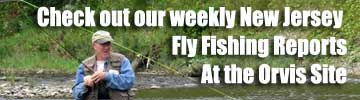
Click the image on the right to go to our weekly updated fly fishing reports through Orvis.
Updated river flows and wading guides are below.
The Musconetcong River
The "Musky" as it is called by all who know it flows southwest out of Lake Hopatcong. Downstream from Saxton Falls in Allamuchy, the Musky begins to take on a normal freestone flow. It contains seasonal trout water to the town of Changewater. From Changewater to the confluence with the Delaware, the Musky mixes with the limestone ground water, cooling down and becoming a better year round trout river. The area just below Penwell includes the Point Mountain TCA, a popular fishing destination. This river holds stocked brooks, browns and rainbows and some wild browns and wild brook trout. The Musky has 19 known trout production tributaries entering into it.
Total miles: 43
Character: Freestone/heavy limestone influence averaging 35 - 65 feet wide
Trout Concentration: Below Penwell Dam to Delaware River
Special Regulation Water: Point Mountain Trout Conservation Area encompassing 1.2 miles from the Penwell Bridge down to the Point Mountain Bridge.
Musky Fishing and Wading based on USGS stream flows
Under 125 cfs - Give the fish a break, river is too low.
100-150 cfs - Tough fishing with spooky Trout. No reason to wade.
150 - 350 cfs - Best flows for fishing. Wade with caution.
350-500 cfs - Fish will move out of the heavy current. Treacherous wading conditions.
Over 500 cfs - Tough conditions, look for smaller water in the area .Do not wade.*cfs = Cubic Feet per Second
The Pequest River
This beautiful tributary of the Delaware River is located in Northwestern New Jersey. Famous for its Trout Hatchery, the Pequest offers angler easy access and opportunities for Trout fishing. There are many runs, pools and pocket water holding a combination of Rainbow, Brook, and brown trout. Exploration of the Pequest River beyond the Hatchery Trout Conservation Stretch will open up many opportunities for solitude and fish.
Total Miles: 24.7
Character: Freestone/heavy Limestone influence averaging 25-50 feet wide
Trout Concentration: Below Great Meadows to the Delaware River
Special Regulation Water:Pequest Hatchery Trout Conservation Area. Encompassing 1.6 miles from the Conrail Railroad Bridge to Pequest Furnace Rd. Bridge.
Pequest Fishing and Wading based on USGS stream flows
50cfs and below-Give the fish a break, river is too low.
50-100cfs-Tough fishing with spooky Trout. No reason to wade.
100-150cfs- Low flows for fishing.
150-200cfs-Best level for fishing.
200-250cfs-Good flows for fishing Wade with caution
300+cfs- Fish the banks and slower water, wade with caution.
400+ cfs- Tough conditions, look for smaller water in the area .Do not wade.*cfs = Cubic Feet per Second
South Branch of the Raritan River
One of NJ's finest rivers, the South Branch of the Raritan River gets it's start at Budd Lake. The South Branch flows from it's headwaters to were it converges with the North Branch of the Raritan River, and forms the main stem Raritan River. In the upper reaches the South Branch holds many Wild fish. The Claremont stretch is known for small wild reproducing Brook and Brown Trout. Meandering through Long Valley to Califon, it is Stocked with Rainbows and has many stretches of excellent Dry fly water. Below Califon it enters the Ken Lockwood Gorge Special regs water. This is some of the best nymphing water in New Jersey. The lower Trout stretches are through High Bridge, to the Mill in Clinton.
Total Miles: 51 miles
Character: Freestone/some spring influence 20-45 feet wide
Trout Concentration: Mount Olive to Clinton Township.
Special Regulation Water: Claremont Stretch. Encompassing 1.1 miles from the downstream end of the posted fishing club property downstream to its junction with Electric Brook (approx.) Ken Lockwood Gorge. Encompassing 2.5 miles from below Hoffman's Crossing Rd. to the posted fishing club property.
Private Closed Water:
Below Naughright Rd. Bridge, Mt.Olive
Below Bridge on Rt. 513 and intersection Vernoy Rd., Middle Valley
Below end of Ken Lockwood Gorge
South Branch Fishing and Wading based on USGS stream flows
50cfs and below-Give the fish a break, river is too low.
50-100cfs-Tough fishing with spooky Trout. No reason to wade.
100-150cfs-Good flows for fishing. Wade with caution.
150-200cfs-Best level for fishing. Treacherous wading conditions.
200-250cfs-Tough conditions for fishing. Fish the slow edges. Do not wade!
250+cfs-Stay home and tie some flies.*cfs=Cubic Feet Per Second